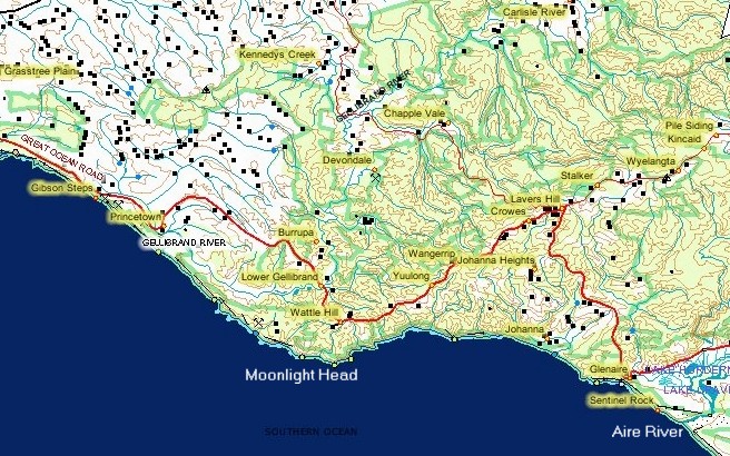
Great Ocean Road
Lavers Hill to Gibson Steps
PDF Great Ocean Road Travel Notes LaversHill to Gibson's Steps
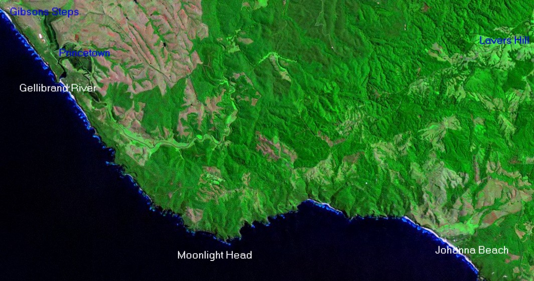
Great Ocean Road Satellite Image Lavers Hill to Gibsons Steps
Lavers
Hill is located in the lighter coloured area in upper right of image.
The white area almost directly below this(bottom of image) is Johanna
surf beach. Exceptionally large waves break on this beach in the right
conditions. The large headland to the left of the image is Moonlight
Head.
The mouth and estuary of the Gellibrand River is visible in
upper left hand of image. The white beach in the most upper left hand
of image is the beach below Gibsons Steps.
Lavers Hill to Gibson Steps
Road Video
Aerial Video
Aerial Photos Johanna Beach to Gibsons Steps
Picture Gallery Lavers-Gibsons Steps Road Melba Gully Moonlight Head Princetown Gibsons Steps
Things to Do and See Lavers Hill Princetown
Shops Fuel Eating Accommodation Lavers Hill Princetown
Back to Main Great Ocean Road Map
Next Section of the Great Ocean Road 12 Apostles
Previous Section of the Great Ocean Road Apollo Bay to Lavers Hill
Great Ocean Road Facts
Lavers Hill to Gibsons Steps
Melba Gully State park is located just past Lavers Hill on the Great Ocean Road and is well worth the walk.
Moonlight Head and Wreck Beach are located a few kilometres off the Great Ocean Road and give access to historic ship wrecks.
Moonlight Heads has a good lookout called The Gables that is 130 metres above sea level.
There are 366 steps down the cliffs to Wreck Beach to the west of Moonlight Heads.
A walk down the historic Gibson Steps gives a unique view of the first two of the Twelve Apostles. The steps have been concreted and modenised to improve access and safety but in the old days these steps were hand cut into the soft mud stone of the cliffs and were trecherous in wet weather.
Princetown is a tiny settlement situated on a hill overlooking the Gellibrand River flood plains and the Great Ocean Road. The mouth of the Gellibrand River can be accessed from just beyond the turn off to Princetown.
Princetown is home to approximately 30 people.
An interesting diversion from the Great Ocean Road is the old Great Ocean Road turn a few kilometres past the Moonlight Head turnoff. This takes you along the Gellibrand River flood plains back into Princetown. it is a dirt road and should not be used after heavy rain due to flooding.